


 Locations






GUEST SUBMISSION: Industrial land is one of Metro Vancouver’s most constrained and strategically important resources, and an important foundation of the economy. To understand how these lands are distributed and used the Metro Vancouver Regional District prepares an inventory every five years. This quinquennial update was last completed for the year 2025, and recently published.
The inventory looks beyond market cycles. With virtually all real estate development indicators down, the industrial sector is experiencing lower rents and reduced construction activity.
Yet with the largest port in Canada expanding and trade volumes growing, the long-term industrial fundamentals remain strong, supporting broader economic and employment activities.
The most recent regional inventory tracks some 12,000 hectares (30,000 acres) of land, ranging from heavy to light, traditional to modern, and big to small.
The report provides a comprehensive snapshot as of July 1, 2025, detailing the amount, type, and use of industrial and industrial-related lands, allowing for comparison with the previous 2020 inventory.
Industrial matters
Metro Vancouver benefits from a diverse industrial ecosystem for: small and light urban industrial businesses, manufacturing, logistics and distribution, construction-related contractors, larger industrial campuses, trade-oriented uses, and transportation infrastructure.
As well as emerging sectors associated with export diversification, food processing, mass timber products, defence manufacturing, and high-tech. These sectors are all needed for a prosperous economy.
To provide content and purpose for the inventory:
Metro Vancouver’s Industrial lands are critical to providing jobs for residents, supporting the region’s businesses, and enabling international trade. Although they account for just four per cent the land base, Industrial lands host about 22 per cent of Metro Vancouver’s jobs, generate 30 per cent of GDP, and contribute approximately $8 billion in tax revenues to various levels of government.
The availability of Industrial lands is also key to international trade through the Port of Vancouver, Canada’s busiest port, and Vancouver International Airport. Meeting the needs of a growing regional economy and gateway for trade requires an adequate supply of Industrial lands.
The inventory universe
The Inventory maps industrial lands across Metro Vancouver’s nine sub-regions. Thirty detailed land use classifications were used (consolidated into seven land use categories for ease of reporting), ranging from typical industrial uses of General Industrial, Manufacturing, and Warehouse, to Utilities, Rail Yards, and Port Terminals associated with infrastructure and transportation, to Retail, Office, and Recreation which are commercial uses, to Agriculture, Residential, Resource Extraction, and other uses classed as ‘Vacant’, reflecting lands not currently in industrial use.
One might ask why non-industrial ‘uses’ appear on industrial ‘lands’.
The inventory tracks lands designated for industrial use, not just those currently operating as industrial. A site may presently have a non-industrial use until it is redeveloped. In other cases, municipal regulations may allow for some non-industrial uses on industrial lands.
While some local servicing retail and accessory office uses can be supportive of an industrial district, larger scale commercial uses, destination gyms, and sports facilities can disrupt the area by competing with industrial tenants, increasing rents, introducing land use conflicts, and leading to property speculation.
Other uses like port terminals, rail lines, and airports may not be industrial, but such transportation infrastructure directly supports the movement of goods, international trade, and the distribution sector.
Inventory stats and facts
As of mid 2025, there were 12,067 hectares of land in the inventory:
- 77 per cent (9,277 ha) were classified as Industrial use.
- 17 per cent (2,028 ha) were Other/Vacant – either totally vacant or with non-industrial uses, some of which could convert to industrial in the future.
- Six per cent (763 ha), a small but significant portion, were commercial uses, which are unlikely to convert to industrial.
The largest category (40 per cent) of industrial uses were Building-Intensive Industrial, which comprises General Industrial, Mixed Industrial/Commercial, Manufacturing/Production, and Distribution/Warehouse uses. This was followed by Large-Scale Infrastructure/Transportation (27 per cent), reflecting the significance of the Port of Vancouver and Vancouver International Airport.
More than half of the lands (54 per cent) are located in the southern and eastern parts of the region: 22 per cent in Surrey, 17 per cent in Delta/Tsawwassen First Nation, and 14 per cent in Richmond.
Around two-thirds (68 per cent) of the lands were privately owned, with an additional four per cent owned by railways. The balance (28 per cent) were owned by various levels of government. Ownership patterns influence development timing.
Change over time - where development is occurring
In terms of changes in supply between 2020 and 2025:
- Despite ongoing pressure on industrial lands, there was a net increase of 195 ha (2%), continuing the trend of approximately 250 ha in 2015-2020.
- New parcels were added as they became municipally designated industrial, supporting the region’s long-term industrial capacity. Major additions were in Surrey (Campbell Heights, 154 ha), Delta (Tilbury, 22 ha), and Maple Ridge (Yennadon, 16 ha).
- Other jurisdictions, including Burnaby and Vancouver, saw net decreases. Parcels were removed mostly due to local policy changes.
- Removed lands were proportionally more likely to be in the region’s Urban Centres, where they can readily serve other businesses in the area.
In addition to changes in supply, absorption reflects lands moving from vacant to developed status, driven by market forces and development projects:
- Development absorbed 379 ha of land, about half of which were developed for Distribution/Warehouse use, associated with trade and transportation sectors.
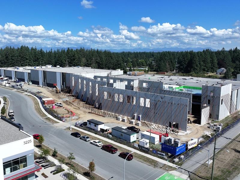
- Key areas where lands were absorbed were in Surrey (Campbell Heights), Burnaby (Big Bend), and Pitt Meadows (airport area).
- Net absorption in 2020-2025 (average 76 ha per year), roughly similar to past periods.
- Industrial growth is increasingly occurring in the edges of the region reflecting land availability, while industrial land in the central areas are under greater pressure. In some cases, older industrial properties are being redeveloped as modern facilities with higher densities, while in other cases as commercial and industrial uses.
Into the future
The quantity of industrial land is only part of the story. The functionality of lands also depends on location, parcel size, transportation access, infrastructure servicing, permitted uses and the surrounding context.
The future use potential of the lands is guided by several key attributes.
- The average parcel size is 1.4 ha, informing the possible scale and type of tenants:
- Smaller sites under 1 ha account for 17 per cent of lands (6,154 sites), which typically accommodate small-scale, local-serving industrial uses.
- Larger sites above 5 ha account for 47 per cent of lands (355 sites), are suitable for larger manufacturing, logistics, and infrastructure uses.
- 97 per cent of lands were municipally designated industrial (in OCP or equivalent), securing the industrial activities into the long-term.
- Three per cent were zoned industrial but not designated industrial, indicating that industrial uses may change over time.
- 87 per cent were regionally designated either Industrial (64 per cent) or Employment (23 per cent) in the Regional Growth Strategy.
However, as some of these designations permit a broader range of uses, industrial uses may face competition from other uses.
The distribution of vacant industrial lands by sub-region varies greatly, with few in Vancouver and the North Shore, and more in the southern and eastern parts of the region:
- Tsawwassen First Nation lands, near the Roberts Bank Terminal and accessible by the South Fraser Perimeter Road.
- Campbell Heights in south-east Surrey, an expanding industrial business park.
- North-east Maple Ridge, included in a new industrial lands area plan.
These lands provide opportunities to accommodate industrial growth, yet their development timing depends on market demand and site-specific conditions.
Conclusion
Ensuring an adequate industrial land supply — both quantity and quality — is essential to the region’s long-term prosperity and resiliency. The challenge is not simply to preserve industrial land, but to ensure it is functional, well-located, and accessible, capable of supporting the next generation of businesses, jobs, and trade activity for a rapidly evolving economy.




 Industry Events
 Locations

